Pages

Saturday, December 27, 2014

Williamsburg Trust Company - Holy Trinity Orthodox Church

South Facade of Williamsburg Trust Company
Williamsburg Trust Company South Facade
East Facade of Williamsburg Trust Company
Williamsburg Trust Company East Facade
Across from the Continental Army Plaza and couple of blocks from the Williamsburg Savings Bank sits the Helmle & Huberty Designed Williamsburg Trust Company bank building.[1] Helmle & Huberty was a prolific Brooklyn Architecture firm that produced designes for many of the landmark worthy buildings in New York City. Built in 1906, the building's Roman style architecture was influenced by the World's Columbian Exhibition of 1893.[1] A fine example of Bank Architecture, the Trust Company building's design elements included Tetrastyle porticoes with triangular pediments and marble ionic columns with a facade veneered in glazed white terra-cotta. The building bears some similarity to the Helmle & Huberty designed Greenpoint Savings Bank built two years later and employs the same glazed terra-cotta building material as the Boathouse in Prospect Park that Helmle & Huberty designed two years prior. "The glazed coating of the antefixae of the fine saucer dome, set on a heavily crested octagonal drum, and of the balustrades atop the wings flanking the porticoes, etched against the sky, glisten in the sun."[2]


South Facade Relief 1 Left Side of Building
South Facade Relief 1

South Facade Relief 2 Center of Building
South Facade Relief 2

South Facade Relief 3 Right Side of Building
South Facade Relief 3

Above are the terra-cotta reliefs that sit atop the building's south facing entrance.


East Facade Relief 1 Left Side of Building
East Facade Relief 1
East Facade Relief 2 Center of Building
East Facade Relief 2
East Facade Relief 3 Right Side of Building
East Facade Relief 3
Above are the terra-cotta reliefs that sit atop the building's east facing entrance.

References:
  1. White, Norval, Willensky, Elliot, and Leadon, Fran AIA Guide to New York. Oxford University Press, 2010.
  2. Morrone, Francis An Architectural Guidebook to Brooklyn. Gibbs Smith, Publisher, 2001.

Sunday, November 30, 2014

Kosciuszko Bridge & Penny Bridge - Meeker Avenue Bridge

Bird's Eye View of Kosciuszko Bridge from Bing Maps
As the end of the Kosciuszko Bridge draws near it seems appropriate to reflect on the soon to be demolished structure, as well as the former spans that once connected Greenpoint to the Queens side of Newtown Creek. The Kosciuszko was built to replace the Penny Bridge (a.k.a. Meeker Avenue Bridge); however, the Penny Bridge was not the first structure in the area to span Newtown Creek. The Penny Bridge's predecessors included a bridge built on wood piles after the war of 1812 which was replaced in 1836 by a bridge on stone piers. The toll to cross the 1836 structure was 1 penny, hence the origin of the name for the Penny Bridge built in the late 1800s.[1]


Penny Bridge abutment
Penny Bridge Abutment on Queens Side
Area map showing location of Penny Bridge
Penny Bridge Location & Site Context
Little if any physical evidence remains of the two earliest bridges, however the abutments of the Penny Bridge can still be seen on the banks of Newtown Creek. Built in 1894, the Penny Bridge was the main link from Greenpoint, Brooklyn to Sunnyside and Maspeth, Queens via Meeker Avenue. The Penny Bridge was a turntable bridge spanning 144 feet across Newtown Creek. According to publications immediately prior to demolition of the structure, the bridge "wreaked havoc" on shipping traffic due to its low clearance and turntable design. To open, the bridge would pivot from an island in the middle of the creek 1/3 the size of the span creating a channel on either side of the structure. The larger channel, measuring approximately 53 feet wide, determined the limit of the size of vessels that could pass.[2] Although the island that housed the bridge's pivot no longer exists its property lines are still part of Sunnyside Queens according to Google Maps.


Kosciuszko Bridge from end of Meeker Avenue
Kosciuszko Bridge from Former Site of Penny Bridge
Construction on the Robert Moses era Kosciuszko Bridge began on May 25th of 1938 and it was completed in August of 1939.[2] Originally named Meeker Avenue Bridge, the Kosciuszko was renamed in 1940 to honor the Polish patriot and Revolutionary war hero Thaddeus Kosciuszko.[3] The structure is a truss bridge measuring 6,400 feet long, making it 384 feet longer than the Brooklyn Bridge, and 125 feet high.[2][4] At the time it was built the span had the distinction of being the longest bridge over a narrow waterway in the world.[4]


New Footprint of Kosciuszko Bridge
As the cycle of construction life marches forward there will soon be yet another bridge constructed to replace the Kosciusko. At the time of this blog post construction mobilization is underway to replace the old Kosciuszko with a new modern Kosciuszko Bridge that will meet current safety standards and help elevate traffic congestion with additional, wider lanes and a reduced road incline. In addition, the new bridge will include a shared use path for cyclists and pedestrians.[5] The proposed structure will be built in the roadbed adjacent to the existing Kosciuszko Bridge (see photo above).[6]

References:

  1. "'Penny Bridge' Inquiry Evoked Many Replies" Brooklyn Daily Eagle 24 September, 1950
  2. North, Leslie "Boon to Industry" Unknown Publication Source 4 August, 1939
  3. Ingersoll, Kosciuszko Memorials Approved" Brooklyn Daily Eagle 17 October, 1940
  4. "A Fact A Day About Brooklyn" Brooklyn Daily Eagle 29 July, 1941
  5. New York Sate DOT online.
  6. Mitch Waxman "Poison Cauldron of the Newtown Creek" Atlas Obscura tour. 


Sunday, November 16, 2014

McGovern Weir Greenhouse Across from Green-Wood Cemetery

McGovern Weir from intersection
McGovern Weir Greenhouse
Across from the main entrance of Green-Wood Cemetery at 5th Avenue and 25th Street is the only surviving Victorian style commercial greenhouse in New York. "The Greenhouse is a wood frame structure enclosing glass pains, and has glass and galvanized-iron roof surfaces."[1] Much of the structure's bold appearance can be attributed to its domes, as well as the projecting bays and corner entrance vestibule. The McGovern Weir Greenhouse was commissioned by James Weir Jr. and designed by architect C. Curtis Gillespie who lived near the site.[2]

McGovern Weir Greenhouse Dome & Weir Sign
James Weir Jr. inherited a love for the flower trade from his father James Weir Sr. who came to America from Scotland in 1844 and entered the flower business in Bay Ridge. In 1861 the Jr. Weir went into business for himself as a florist.[3] Later, in 1866 James Weir Jr. moved his business to 24th Street and 5th Avenue to serve those visiting Green-Wood Cemetery. Then, he moved to 25th Street between 4th and 5th Avenues. Finally, Weir's last move came after 1880 when he commissioned prominent local architect Mercien Thomas to design a greenhouse on the site where the surviving Weir Greenhouse now sits. Mercien Thomas's building was replaced by the current structure in 1895.[1] The Weir greenhouse was a Family business owned by James Weir Jr. and operated with the help of his son and grandson, all of whom lived nearby at 236 and 228 25th Street. The greenhouse remained in the Weir family until 1971 when it was sold to the McGovern family.[2] 

McGovern Weir Greenhouse Entrance & McGovern Sign
After the McGoverns took over the Weir business the Greenhouse faced a slow decline. A New York law banning the use of water filled containers in graveyards during mosquito season (April 1 - October 15) and subsequent declining demand for fresh flowers made it difficult for the McGovern family to be able to afford the maintenance on the landmarked structure. So, in the fall of 2010 the McGoverns had the property listed for sale. The McGovern family continued to operate the Greenhouse until 2012 when the property was sold to Greenwood Cemetery.[3] The current plans for the old Greenhouse include restoration and conversion into a visitors center for the cemetery. The cemetery is currently accepting donations to help cover the high cost of restoration.


Sources:
  1. Dolkart, Andrew S. New York City Landmarks Preservation Commission. Weir Greenhouse New York, 13 April, 1982
  2. Richman, Jeff "It's Ours" Green-Wood.com 6 February, 2012
  3. Gray, Christopher "Sale May Rescue Ruined Greenhouse" New York Times 10 July, 2011


Friday, October 31, 2014

Harte & Company Building - Greenpoint

Curved, glass block and brick wall at corner of Franklin Street and Commercial Street
Harte & Company Building, Corner of Franklin and Commercial
Manufacturing equipment on roof of Harte & Company building
Harte & Company Roof-top Manufacturing Equipment
The far northern end of Greenpoint between Franklin Street and Manhattan Avenue is my favorite part of the neighborhood. It still retains some of the industrial character that once defined Greenpoint. Soon, much of what's left of that character will be erased as the area is transformed into gated communities in the sky. The next building up for demolition in northern Greenpoint appears to be the Harte and Company building at 280 Franklin Street. Although the Harte and Company building was among the buildings highlighted in the Preservation League of New York's "Seven to Save" list in 2006, the New York City Landmark's Preservation Commission declined Preservation Greenpoint's request to consider granting the building landmark status. Demolition permits have been filed for most of the building.[1] It seems to be only a matter of time before most of the structures are razed; however, demolition permits have not been filed for the main part of the building.[2] So, hopefully the iconic curved glass block wall and mechanical apparatus on the roof will be incorporated into the proposed development.

Harte & Company Building from corner of Franklin Street and Dupont Street
Harte & Company - Corner of Franklin Street and Dupont Street 
Aerial photo of Harte & Company Building
Aerial of Harte & Company Building
Harte & Company Building entrance
Harte & Company Entrance
Spanning half a city block, the Arte Moderne style Harte & Company building was constructed circa 1930 by an unknown architect.[2] The Nuharte and Company manufactured shower curtains, upholstery and other plastic products in Greenpoint's Harte & Company building until the plant closed in 2004. Prior to plastic manufacturing, the site was used for manufacturing boilers, light fixtures and soap.[3] The only piece of information I could find about the building in the Brooklyn Library's archives is that part of the building is an addition. Judging by aerial photography, my guess is that the building is two separate structures (highlighted in the aerial above). The granite veneer at the building's entrance on Dupont Street also appears to be an afterthought or addition to the original structure.


Resources:
  1. Croghan, Lore "Greenpoint: Has the Sale of the former Harte & Co. Factory Closed" Brooklyn Daily Eagle online. 9 April, 2014.
  2. "Demolition Parmits Filed for Harte & Co. Factory Complex in Greenpoint" Brownstoner 26 August, 2014.
  3. Short, Arron "Greenpoint Plastics Company is a Superfund Site" Brooklyn Paper online. 20, July 2010.

Friday, October 24, 2014

Weeksville and the Hunterfly Road Houses-Crown Heights

Weeksville Heritage Center
The Hunterfly Road Houses are the remnants of Weeksville, a once thriving free African American community founded in New York shortly after slavery was abolished in the state. Weeksville was founded by James Weeks, a former slave from Virginia who wanted to empower his people with the right to vote. Unlike their white counterparts African Americans were required to own land in order to gain voting rights. So, when an economic downturn caused real-estate prices to drop James Weeks seized the opportunity to gain a political foothold by purchasing land in Brooklyn.[1] The neighborhood founded by Weeks also provided a safe and more prosperous environment for his people and served as a refuge for runaway slaves and those fleeing the draft riots in Manhattan. Weeksville was a self sustaining community that included its own doctors, teachers and social service providers.[2]


Two story white Hunterfly Road House
Hunterfly Road Houses
One story white Hunterfly Road House
Hunterfly Road House
Two story yellow and green Hunterfly Road House
Hunterfly Road House
Once lost to history, the connection of the Hunterfly Road Houses to Hunterfly Road and Weeksville were discovered in 1968 by a Pratt Institute Professor named James Hurley and pilot Joseph Haynes while conducting an aerial survey of Bedford Stuyvesant for a university project.[3] The Hunterfly Road Houses were built parallel to Hunterfly Road, a Colonial road that had once been a Native American trail. The four wood frame houses span from 1698 Bergen Street to 1708 Bergin Street and were built circa 1840 by an unknown architect/architects. They are the oldest surviving homes in the neighborhood.[4][5] The dwellings still retain the character of their once rustic setting and the land adjacent to the houses has been reworked to echo the pastoral aesthetic the area once had. Today the Hunterfly Road Houses are used as a museum run by the Weeksville Heritage Center for artifacts found during archaeological investigations.


Interior of Hunterfly Road House with chair and butter churner
Hunterfly Roadhouse Interior
Interior of Hunterfly Road House with chair next to quilt on quilt rack
Hunterfly Roadhouse Interior
Pictured above are items inside the houses that would have been used around the time that the homes were built.

Although my focus was on the architecture, there is more to see at the Weeksville Heritage Center than the Hunterfly Road Houses. The center also has a cultural arts facility featuring interpretive displays, exhibits, an event space and a garden. While I was there they had artifacts on display from their archeological collection as well as an exhibit on the changing demographics and gentrification of Bedford Stuyvesant and Crown Heights. I recommend a visit to the Weeksville Heritage Center for anyone interested in Black History or the history of Brooklyn. Also, if you have kids you can make a day of it by visiting the Brooklyn Children's Museum nearby as well.


Tourist In Your Own Town #7 - Weeksville Heritage Center from New York Landmarks Conservancy on Vimeo.

References:
  1. Brooklyn Historical Society interpretive display
  2. Rezvani, Bijan "Weeksville" The City Concealed. online. 10 March, 2009
  3. "Hunterfly Road Houses" New York Preservation Archive Project. 2010
  4. New York City Landmarks Preservation Commission. Houses on Hunterfly Road New York, 1970.
  5. Tours Page Weeksville Heritage Center online.

Saturday, October 11, 2014

Domino Sugar Refinery - Williamsburg

Domino Sugar Refinery in Williamsburg Brooklyn from the East River
Domino Sugar Refinery from East River
Opining in 1857, the 11 acre Domino Sugar Refinery was one of several Brooklyn Sugar Refineries built in the 19th century. By the turn of the century over half the sugar in the world would be produced in Brooklyn. Domino Sugar, previously known as the Havemeyers & Elder Filter, Pan & Finishing House, then, the American Sugar Refining co. was a conglomerate of 17 sugar refining companies that once combined made up the largest sugar refining company in the world.[1][2] By 1897 output of the American Sugar Refining co. was 1,200,000 tons of refined sugar a day.[3] The sugar refinery has hosted labor protests, community preservation rallies, parties and most recently an art exhibition. Today, most of the sugar refinery is being demolished to make way for a new mixed use development. 


Domino Suger Refinery from the East River toward the Williamsburg Bridge
Domino Sugar Refinery from East River
On July 28th, 1910 unrest over low wages and "various abuses" erupted into a riot of 1,000 refinery picketers on strike along with 2,000 sympathizers leading to clashes with police and Sugar Refinery security. "One man was killed, six were seriously hurt, and at least a hundred received minor injuries from the clubs of police." The death was that of Walla Noblosky who was allegedly shot by the company's cashier.[4] The riots would later be attributed to emboldening workers at the Greenpoint Terminal Market (American Manufacturing Co.) in nearby Greenpoint to go on strike.


View from Williamsburg Bridge of Domino Sugar Refinery undergoing demolition
Domino Sugar Refinery Undergoing Demolition
Eventually market pressures including artificial sweeteners, government subsidized high fructose corn syrup and cheaper labor costs else-wear  lead to a decline in demand from the Brooklyn plant and on January 30th, 2004 all factory operations at the Williamsburg site ceased.[2][5] Around the same time much of the Brooklyn waterfront was rezoned for high rise residential development making the old refinery site an attractive property to real-estate developers. The site has changed hands a few times since 2004 with differing visions for the would be development. Each new version of development brought renewed conflict between developers and preservationists over the fate of the site's structures and land use. With historic buildings along the Brooklyn waterfront rapidly disappearing,  preservationists wanted to protect the industrial heritage of north Brooklyn and save the refinery structures from demolition. 


Save Domino Sign
Save Domino! The fight between developers and the community led to concessions on both sides. The current Developer increased the number of affordable housing units to be built in the development and are making efforts to preserve salvageable relics from the refinery, including the Domino Sugar sign, to include in the new site and building designs. The developers are also building accessible waterfront parkland and a school as part of an agreement with the city.


View of Domino Sugar Refinery's Landmarked Building from above on Williamsburg Bridge
Domino Sugar Refinery's Landmarked Building from Above
View of Domino Sugar Refinery from adjacent lot
Domino Sugar Refinery's Landmarked Building from Below
In addition to what the developers are voluntarily preserving, the Landmarks Preservation Commission granted Landmark Status to one of the Domino Sugar Buildings in 2007 to protect it in perpetuity. The landmarked red brick structure was built 1881-1884 to replace a building that had been destroyed by fire. Designed by Theodore A. Havemeyer with Thomas Winslow & J.E. James in the American Round Arch style, a variant of the German Rundbogenstil and Romanesque Revival style, "the Filter, Pan and Finishing House were designed to give the appearance of a single monumental structure". At 150 feet tall plus a large chimney, the structure towers over the neighborhood. The building lacks setbacks and most of the ornamental brick work is concentrated on the upper stories of the building which allowed construction to proceed more quickly.[1] Topping the more ornate upper portion of the building, the renovated structure will have an added four stories of glass clad offices. Once finished, the Filter, Pan and Finishing House will be used as office space marketed to creative tech industries.

Kara Walker's grand scale Sugar Sphinx featured inside the Domino Sugar Refinery
Kara Walker's Sugar Sphinx
In June of 2014 the Domino Sugar Refinery was bid farewell with "A Subtlety" an art exhibit featuring Kara Walker. Her monumental Sugar Sphinx and human scale sugar babies are meant to remind the viewer of the horrors of the salve trades' involvement in sugar production and our connection to it. I had never read about the slave trade related to sugar; however, the artwork was very accessible and it wasn't difficult to understand the implications of the installation. Remembering the history of sugar seemed like a fitting end to the historic Domino Sugar Refinery - R.I.P. Domino (1857-2014).


Created with flickr slideshow.

The slideshow above includes additional photos including some interior shots. However, a more thorough photo exploration was undertaken by Paul Raphaelson. Paul was allowed into the site to photograph the iconic refinery prior to demolition and he is selling prints to finance production of his book "Sweet Ruin: The Brooklyn Domino Sugar Refinery".


References:
  1. New York City Landmarks Preservation Commission. Havemeyers & Elder Filter, Pan and Finishing House. New York, 2007
  2. Ellis, Will "Inside the Domino Sugar Refinery" Abandoned NYC. 21 May, 2012
  3. Brooklyn Daily Eagle. 15 February, 1897
  4. "One Dead, Many Hurt In a Bloody Roit of Sugar Strikers" Brooklyn Daily Eagle. 28 July, 1910
  5. McShane, Larry "Sugar Plant Closes after 148 Years" Associated Press. 29 January, 2004

Friday, September 19, 2014

Gowanus Bat Cave

Gowanus Bat Cave
Gowanus Bat Cave
I discovered the Gowanus Batcave a little too late since redevelopment construction had already begun. However, I was still able to get some photos of the exterior before the building began its outer transformation. These photos were taken last spring, so the building probably looks much different now.

Gowanus Bat Cave from back of Storage Deluxe building
Gowanus Bat Cave from the Storage Deluxe
For the past couple of decades the Gowanus Bat Cave was a roost for local bats, as well as a squatter refuge and party/concert venue but the building was originally built as a factory. The factory housed the Nassau Sulfur Works, Smith and Shaw Mattress Materials and Paper Stock. In 1904 the building was purchased by the BRT and repurposed for use as a coal fired power station for the Brooklyn Trolly System. After the demise of the Brooklyn street cars the power plant was no longer needed and was converted into an electrical substation and switching yard by the MTA. The red brick building with Romanesque Revival details was constructed in 1896 and was abandoned in 1996.[1][2]

Gowanus Bat Cave from across the Gowanus Canal
Gowanus Bat Cave from the Gowanus Canal
After being abandoned, local squatters from Brooklyn and Tomkins Square Park, followed by others from various parts of the country moved in and began making improvements, including a sanitary system utilizing rain water and electricity pirated from the Carroll Street Bridge. Shortly after being converted from bat cave to squat the building turned into a heroine shooting gallery gaining notoriety in 2006 when a Daily News article exposed the lifestyle and living conditions of those who had taken up residence there. Included in the article were details of the interviewees shooting up during the interview, overdoses and a man being thrown from one of the upper floor windows.[3] At the time of the article there were plans to redevelop the site into luxury condos called "Gowanus Village" and the developer had no interest in allowing the party to continue. The building's entrances were sealed and a guard was posted. However, plans to redevelop the site were later abandoned, allowing the Bat Cave to continue its slow decline. Then, the building was purchased in 2012 by Joshua Rechnitz, a reclusive, camera shy philanthropist and cycling enthusiast with plans to convert the place into artist studios.[4] As of my last visit to the Bat Cave construction was under way and although I could have gained access to the site by boat, there would have been little left to see inside the building. Some of the best interior photos can be found on Untapped Cities.


Gowanus Bat cave from the Smith and Ninth Street elevated subway platform
Gowanus Bat Cave from Smith & Ninth Train Platform

Gowanus Dredgers kayak launch across from Gowanus Bat Cave
Gowanus Canoe Club
Those interested in a tour of the Gowanus area by boat can visit the Gowanus Dredgers Canoe Club located directly across from the canal from the Bat Cave.

References:
  1. "Decontamination Planned for Gowanus Bat Cave" Brownstoner.com 6 January, 2014
  2. "Imagining a New Artsy Life for Decrepit Gowanus Bat Cave" Curbed.com 
  3. Sederstrom, Jotham "Homeless Rule at the Bat Cave" Daily News. online. 23, October 2006
  4. "Party's Over at Gowanus Bat Cave But Mysterious Millionaire Will Make it F*cking Cool" Gothomist.com 11, March 2013

Sunday, June 15, 2014

Russian Orthodox Cathedral of the Transfiguration of our Lord - 228 North 12th Street

Looking at main entrance of the Russian Orthodox Cathedral in Williamsburg
Russian Orthodox Cathedral-Williamsburg
View of Russian Orthodox Cathedral of the Transfiguration of our Lord from McCarren Park
Russian Orthodox Cathedral-Williamsburg
The verbose titled Russian Orthodox Cathedral of the Transfiguration of our Lord was originally named Saint Vladimir, after the Russian Saint who was a converter of Russians to Christianity.[1] Built in 1921, the church was designed in the Russian Byzantine style by architect Louis Allmendinger.[1][2] Allmendinger was also known for designing the "Mathews Model Flats", progressive tenement buildings in the Long Island City, Woodside, Elmhurst, Maspeth and Rdgewood neighborhoods of Queens.[3] The most striking feature of this building is the large copper onion dome; otherwise the building's design is relatively simple. The church is laid out in a Greek Cross and lacks some of the embellishment of many other notable Brooklyn Churches.[2] Although simple, this Brooklyn church is a striking example of ecclesiastical architecture and a north Brooklyn icon. It was designated a New York City Landmark in 1969.[1]


Plaque 1


Plaque 2


Plaque 3


Plaque 4


Plaque 5


Cornerstone

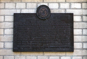
There is quit the array of plaques to remind you of the importance of this church, lest you forget.


References:
  1. Greetings From Greenpoint. Brooklyn Public Library.
  2. Morrone, Francis An Architectural Guidebook to Brooklyn. Gibbs Smith, Publisher, 2001.
  3. "The Mathews Model Flats, A Place That Matters" The Municipal Art Society of New York. Online. 4 March, 2009

Saturday, May 31, 2014

Rockaway Boardwalk of the Past

Pile of surfboards on Rockaway Beach with a girl sitting in the background
Surf Beach at Beach 67th Street
Although Rockaway Beach is not in Brooklyn, it is a favorite spot of many Brooklynites and doing a blog post on the beach made famous by the Ramones seems appropriate. 

Rockaway beach was once a summer resort destination but like many summer getaways of the early 20th century it saw a decline after WWII when mass car ownership fueled an exodus from urban centers. Although, parts of Rockaway have remained a vibrant community with year round residents other parts of the peninsula suffered from urban decay. At its peak the boardwalk hosted amusement parks, food vendors and a summer bungalow community.  More recently there has been a renewed public interest in Rockaway Beach and growing crowds of visitors are coming to the boardwalk, a wider range of food options are being offered and a growing community of surfers are visiting and moving to the area.


Abandoned basketball court next to the Rockaway boardwalk
Abandoned Basketball Courts
Rockaway Boardwalk and adjacent abandoned neighborhood
Rockaway's Forgotten Neighborhood Facing West
Rockaway Boardwalk and adjacent abandoned neighborhood
Rockaway's Forgotten Neighborhood Facing East
Along the eastern end of the Rockaway boardwalk lies the specter of an abandoned beach bungalow neighborhood. The bungalows are gone but the infrastructure, including crumbling streets, telephone poles and and basketball courts remains. Most of the beaches' visitors that come from outside of the Rockaways never venture much further east than Beach 67th Street. The first time I walked east of Beach 67th Street on a beautiful late summer Friday I was surprised to see a large swath of vacant land and an underutilized boardwalk. Much of the boardwalk on the eastern end survived Hurricane Sandy; however, in spite of the good condition of the boardwalk and beautiful weather, there wasn't anyone in site and an eire silence persisted. I must have walked a mile without seeing another person. I was told by some local residents that before hurricane Sandy this area was home to a pack of feral dogs. Fortunately for me they were no longer there. This area between Beach 56th Place and Beach 32nd Street used to be home to a summer bungalow community.

Rockaway bungalow refinished in sand colored stucco
Rockaway Bungalow (Beach 24th Street)
Looking down the street at a row of Rockaway Beach bungalows
Rockaway Beach Bungalows (Beach 25th Street)
There used to be thousands of bungalows on the Rockaway Peninsula; today there are fewer than 400. Construction of the bungalow community began in the early 1900s to supplant tent communities that began to pop up along the boardwalk.[1] The neighborhood of Wavecrest is home to the Far Rockaway Beach Bungalow Historic District. The district is the largest intact portion of the original bungalow community, spanning 3 blocks between Beach 24th Street and Beach 26th Street.[2] Most of these homes were designed by architect Henry Hohauser and constructed by Isaac Zaret in the 1920s.[1] Henry Hohauser is better known for designing Art Deco hotels in Miami.[2] The beach side bungalows were modest summer homes built to meet the recreation demand of working class Russian, Italian, Irish and German Jewish immigrants.[1] The bungalows are all 1-1/2 stories with 3 bedrooms, a kitchen, porch, bathroom and many windows.[2]

There were many factors that may have led to the decline of the beach bungalow community like the closure of the main rail bridge after a fire during the 1950s[2], crime, redlining, cheaper transportation to destinations outside of the city and changing demographic trends. Whatever the reason, many people stopped coming to the Rockaways as a summer getaway and a large swath of bungalow property was abandoned and repurposed for public housing. Not winterized, the bungalows were inadequate as public housing, so their use by the city was short lived and most of the bungalows were demolished in the 1960s under commissioner Robert Moses to make way for apartment complexes, housing projects and the widening of Seagirt Boulevard.[1][3] In place of much of the bungalow community, a derelict land is all that remains.

Although the Rockaway bungalow community has State Landmark Status, it is still vulnerable to demolition by developers and there has been a long running battle between developers and preservationists. In 2011 Bootleg Productions, the producers of Boardwalk Empire donated $10,000 to help preservationists like Richard George and the Beachside Bungalow Preservation Association with preservation efforts for the remaining bungalows.[2]


Boardwalk Empire Set
At the end of my walk through the forgotten bungalow neighborhood where there wasn't a soul in sight, I came across a scene of old cars and men in period clothes wielding shotguns. It was the set of Boardwalk Empire. The show began filming in the Rockaways in 2009. 
Postcard from Rockaways' Playland

Although Rockaways' Playland (formerly located next to the beach between Beach 98th Street and Beach 97th Street) is the longest running and best known of the Rockaway amusement concessions, it was not the first. George C. Tilyou's Steeplechase Park and L.A. Thompson's, Thompson's Park preceded Rockaways' Playland. Both Tilyou and Thompson made names for themselves in the amusement industry. Tilyou was known for helping to make Coney Island one of the most famous amusement parks in the world and Thompson was known for his innovations related to roller coasters. Known by many as "the father of the modern coaster" he held numerous roller coaster patents and his company, "L.A. Thompson Scenic Rail Company" built 50 roller coasters in the United States. Among the various attractions of the two mens' parks were a fun-house, shooting gallery, ski-ball, a two story bathhouse, and the Gravity Wonder (or "Hurricane") roller coaster.[4] 

Eight years after Thompson's death Thompson's Park was sold to a company that added an arena, gymnasium and olympic size swimming pool, as well as other upgrades to the park and reopened it as Rockaways' Playland on May 30th, 1928. The arena was used for boxing matches and circus performances; the pool was once used for international olympic tryouts for female swimmers. Over the years the amusement park was renovated, rides were added and additional transportation options to get the park were offered; however, by the 1970s park attendance was declining. After 86 years of operation, Rockaways' Playland closed its doors for the season in 1985 never to reopen again.[4]


Rockaway Boardwalk (2 Weeks after Hurricane Sandy)
Street Next to Boardwalk (2 Weeks after Hurricane Sandy)
In 2012 the Rockaway Peninsula suffered the wrath of Hurricane Sandy which destroyed much of the boardwalk, as well as many homes and businesses. The community is bouncing back though and beach attendance continues to rise in spite of there being missing sections of boardwalk. Today, Rockaway beach is being redeveloped and new businesses including surf shops, surf schools and summer food vendors like Rockaway Taco and Roberta's are setting up shop at the beach. One interesting vision for the future is a tent hotel based on the original tent communities of the early 1900s. The potential "Camp Rockaway" hotel proprietor is currently raising money for design development on Kickstarter.


References:
  1. "Far Rockaway Beachside Bungalows" A Guide to Historic New York City Neighborhoods Historic Districts Council.
  2. Laterman, Kaya "In Far Rockaway, Recognition for Bungalows" Wall Street Journal. Online. 28 January, 2013.
  3. "Hamilton, William L "Last Stand for a Bungalow Backwater" New York Times. Online. 23, October 2003.
  4. Gottlock, Barbara & Wesley Lost Amusement Parks of New York City. Charleston, South Carolina: The History Press, 2013.